ElevationCheck
Elevation Check is a convenient app that allows you to instantly check the elevation. It uses GPS to accurately display the elevation of your current location. You can also move the pin to any location on the map to obtain the elevation information for that specific point. Important elevation data can be saved as a list for later reference, and you can share it with friends or family in text format. The app also features a switchable aerial map view for more detailed terrain information.
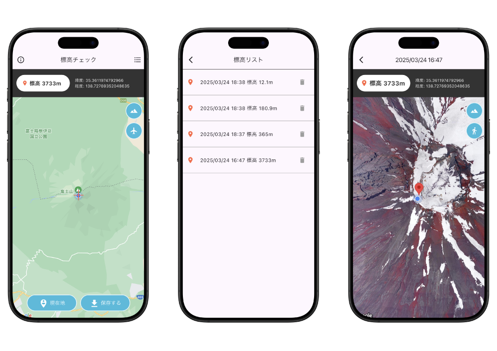
標高チェックは、標高を即座に確認できる便利なアプリです。
GPSを利用して現在地の標高を正確に表示します。また地図上の任意の場所へピンを移動することで、その地点の標高情報も入手可能です。重要な標高データはリストとして保存し、後で参照したり、テキスト形式で友人や家族と共有したりすることができます。航空地図ビューへの切り替え機能も備えており、より詳細な地形情報の確認も可能です。